Marostica
Municipality
Via Livio Tempesta, 17
Marostica (VI) – 36063
Historical overview
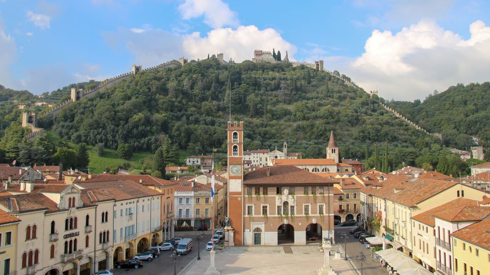
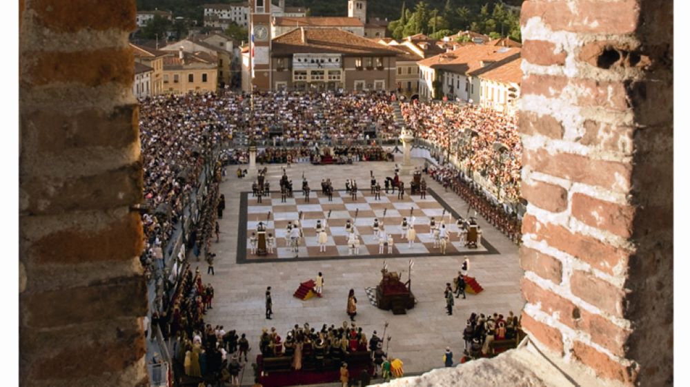
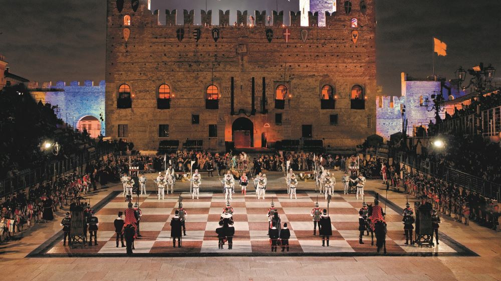
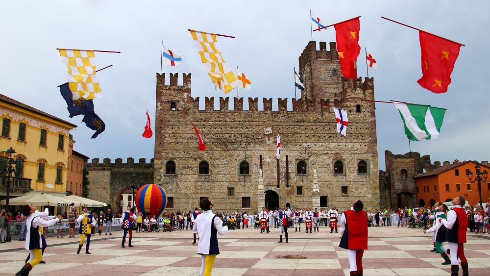
Due to its rich natural resources and favourable geographical location, Marostica has been a fortified city since Roman times, serving as a strategic stronghold to control the plain and the roads to the Altopiano (lit. the Upland). Thus, over time, it has played a pivotal role in the development of Bassano and Vicenza. In the 14th century, to defend the town from enemy attacks, the Scaligeri family, lords of Verona, built the Lower Castle in the plain and the Upper Castle on Pausolino hill, connecting them both through walls. In 1404, Marostica became part of the Serenissima Republic of Venice, and its large square became a symbol of the town’s intense political and commercial life. At the turn of the 19th and 20th centuries, Marostica flourished in the straw industry, experiencing population growth and significant social and cultural changes. The first edition of the Living Chess Game took place in the main square in 1923, featuring participants dressed in 14th-century costumes. During the Second World War, the square’s pavement was unfortunately damaged, but it was restored in 1954 with the addition of a large red and white marble chessboard bearing the Scaligeri emblem at its centre.
City itinerary
This walled city always evokes a strong emotional response. It is characterised by its five-sided walls, which descend along the hillside and connect the Upper and Lower Castles. The walls include a total of twenty-four towers and ravelins, as well as four gates: one at the top of the hill, one next to the Lower Castle (known as “Porta Vicentina” — lit. Vicentina Gate), one to the east (known as “Porta Bassanese” — lit. Bassanese Gate), and one to the west (known as “Porta Breganzina” — lit. Breganzina Gate), in the direction of the hamlet of Panica. Following the typical layout, the so-called “Doglione” Tower connects the two main fortifications and dominates the village and the square. The visit begins by entering through Porta Vicentina, next to the Lower Castle. From the square beyond the Doglione Tower, which was rebuilt in 1930, continue straight ahead along Via S. Antonio. On the right you will see the 14th-century Chiesa di S. Antonio Abate (the Church of St. Anthony the Abbot), which was rebuilt in the 18th century. This church has a Romanesque bell tower, and its construction incorporated the remains of a tower built by the Ezzelini family. From there, a staircase leads to the 17th-century Chiesa dei Carmini (the Carmini Church), where the nature path of the Parco Salin (lit. the Salin Park) begins, leading to the Upper Castle via a panoramic walk. Today, only a few traces of these walls remain, along with part of the frontage and some windows. Meanwhile, the stunning view allows you to fully appreciate the structure of the city and its walls. Following the path, you will soon reach the gate which opens onto the hillside. Return to the city centre on the porticoed Via Mazzini, which is surrounded by 17th- and 18th-century buildings. This street runs parallel to the south-east section of the city walls, which are enclosed by Porta Breganzina on the right and Porta Bassanese on the left. Exit the city walls through Porta Bassanese and walk along the outer perimeter until you reach the car park.
Before you leave, you will encounter the former Chiesa di San Marco (the Church of St. Mark), which is a testament to the city’s relationship with the Venetian Republic. Built in 1450, it was constructed in honour of the Venetian Republic’s patron saint. From here, it is recommended to drive along Via IV Novembre, Via Rimembranza, Via Cangrande della Scala and Via Cansignorio della Scala. This route runs parallel to the southern and western sections of the city walls and leads to the Upper Castle.
Before reaching Porta Vicentina, you will pass the recently restored ancient factory, which was built near the 14th-century walls between 1907 and 1910. It is one of the last and most significant examples of the period in which Marostica was renowned for its straw processing and hat manufacturing industry. The products of this industry are still preserved today at the Ecomuseo della Paglia (the Ecomuseum of Straw) in Crosara, which showcases the peasant traditions of the area.
Another sacred building outside the walls is the Chiesa di S. Maria Assunta (the Church of St. Mary of the Assumption), an ancient parish church which dates back to 1701.
Places of Interest
Per visualizzare tutti i luoghi di interesse del Comune di Marostica accedi alla pagina dedicata e filtra i risultati secondo le tue esigenze.